Introduction
Surveying for disaster management and recovery is an essential practice that supports communities in the wake of natural disasters. It involves the use of precise data collection techniques to assess damage, plan response strategies, and guide the rebuilding process. By utilizing modern surveying technologies, such as drones, satellite imagery, and Geographic Information Systems (GIS), authorities can quickly determine the extent of destruction and prioritize recovery efforts. This article explores how surveying plays a pivotal role in managing disaster impacts and facilitating long-term recovery.
1. The Importance of Surveying in Disaster Management
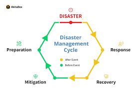
Surveying is an integral part of disaster management because it provides a clear, detailed understanding of the affected areas. Before, during, and after a disaster, surveys allow authorities to gather precise data that informs decision-making.
1.1 Pre-Disaster Risk Assessment and Land Use Planning
One of the essential functions of surveying in disaster management occurs before a disaster strikes. Surveyors help authorities identify risk-prone areas, such as flood zones, earthquake-prone regions, or landslide-prone slopes. Through topographic surveys, hydrological data, and geotechnical studies, surveyors assess the vulnerability of regions to various natural hazards.
This pre-disaster surveying enables governments to implement mitigation measures, such as building regulations, flood control systems, and early warning systems. Moreover, surveys are used to develop evacuation routes and establish critical infrastructure for emergency services.
1.2 Real-Time Survey Data Collection During Natural Disasters
During an ongoing disaster, surveying technologies like drones, GPS, and satellite imagery are used to gather real-time data. Drones, in particular, offer a unique advantage in assessing hard-to-reach areas, such as flooded regions or collapsed buildings, providing crucial information that can be used to direct rescue operations and allocate resources efficiently.
Surveying instruments like total stations and laser scanners are deployed for more precise measurements. These technologies help map the extent of damage to infrastructure, transportation networks, and utilities, enabling authorities to prioritize response efforts.
2. Surveying for Post-Disaster Damage Assessment and Recovery
One of the most important roles surveying plays in disaster recovery is assessing the damage caused by the event. Accurate damage assessments are essential for determining the level of destruction, estimating the cost of recovery, and planning the next steps in rebuilding.
2.1 Infrastructure Damage Assessment with Surveying Technologies
After a natural disaster, surveying teams are tasked with inspecting buildings, roads, bridges, and other infrastructure. Using advanced surveying tools, such as laser scanning and 3D modeling, surveyors create detailed maps that highlight structural damage and identify unsafe areas. This data is vital for engineers and planners to determine whether structures can be repaired or need to be demolished and rebuilt.
2.2 Environmental Damage Surveys for Ecosystem Recovery
In addition to infrastructure, surveying also plays a crucial role in assessing environmental damage. Surveyors use aerial and satellite imagery to monitor changes in ecosystems, such as deforestation, erosion, or contamination from hazardous materials. These surveys are key in directing environmental recovery efforts, including habitat restoration and soil stabilization.
3. Planning for Recovery and Reconstruction Using Surveying Data
Once the immediate disaster response is over, the recovery phase begins. This phase involves rebuilding damaged infrastructure, restoring services, and rehabilitating communities. Surveying is essential for ensuring that the recovery process is efficient, safe, and sustainable.
3.1 Land Use, Zoning, and Rebuilding Strategies Post-Disaster
Surveying provides the necessary data to determine the best land use for reconstruction. Zoning surveys help planners identify areas suitable for residential, commercial, and industrial development. This is particularly important in regions that have experienced extreme disasters, as planners must avoid rebuilding in areas that are vulnerable to future hazards.
3.2 Infrastructure Restoration and Utility Mapping Through Surveying
Surveying is essential for the restoration of utilities such as water, electricity, and telecommunications. Surveyors map existing utility networks, identifying areas that need to be repaired or replaced. In cases of large-scale damage, new networks may need to be designed and constructed. Surveying ensures that infrastructure is rebuilt to meet modern safety standards and is resilient to future disasters.
4. Advancements in Surveying Technologies for Disaster Management and Recovery
Surveying technologies have advanced significantly, enhancing the effectiveness of disaster management and recovery. Some of the most impactful innovations include:
4.1 Geographic Information Systems (GIS) for Disaster Response and Recovery
GIS technology is crucial in disaster management as it allows surveyors and authorities to analyze spatial data and visualize the impact of disasters. By integrating data from multiple sources (e.g., surveys, satellite images, and sensors), GIS systems create maps that depict damage, track recovery progress, and support decision-making processes.
4.2 Remote Sensing Technologies for Disaster Mapping and Monitoring
Remote sensing technologies, including satellites and drones, provide critical data during and after disasters. These technologies offer a bird’s-eye view of affected areas, allowing surveyors to assess large-scale damage quickly. Drones, in particular, are useful for surveying inaccessible or dangerous areas, such as those impacted by floods, wildfires, or earthquakes.
4.3 LiDAR for 3D Mapping and Terrain Analysis in Disaster Zones
LiDAR is an advanced technology used to create highly accurate 3D maps of disaster-stricken areas. By emitting laser pulses and measuring the time it takes for the pulses to return, LiDAR systems generate precise topographic data that can be used to assess terrain changes, map flood zones, or analyze building collapse patterns.
5. Building Resilience and Sustainability Through Surveying in Disaster Recovery
Surveying not only helps in the immediate recovery of disaster-stricken areas but also plays a crucial role in ensuring that communities are more resilient to future disasters. Sustainable development and climate change adaptation are key considerations in rebuilding efforts.

5.1 Designing Resilient Infrastructure Using Survey Data
Surveying helps design infrastructure that is more resilient to future disasters. By using detailed survey data, engineers can build structures that meet stringent safety standards and are designed to withstand natural hazards such as earthquakes, floods, and hurricanes. This includes improving foundations, reinforcing buildings, and designing flood defenses.
5.2 Sustainable Land Use Planning and Risk Reduction through Surveying
Surveying supports sustainable land-use planning, ensuring that areas are developed in ways that minimize environmental impact and reduce the risk of future disasters. This includes implementing green infrastructure solutions, such as rain gardens and permeable pavements, to mitigate flood risks, and preserving natural barriers like wetlands and forests that protect against storm surges.
6. Challenges in Surveying for Disaster Management and Recovery
While surveying is an invaluable tool for disaster management and recovery, several challenges must be addressed:
6.1 Overcoming Accessibility Challenges in Post-Disaster Surveying
In the aftermath of a disaster, accessing certain areas may be difficult due to debris, flooding, or damaged infrastructure. Surveyors must often rely on advanced technologies, such as drones and satellites, to gather data from otherwise inaccessible regions.
6.2 Ensuring Accurate Data Collection and Integration for Effective Recovery
Ensuring the accuracy of survey data is crucial in disaster management. Inaccurate data can lead to misinformed decisions that hinder recovery efforts. Additionally, integrating data from various sources, such as ground-based surveys, satellite imagery, and aerial surveys, requires advanced software and expertise.
7. Conclusion: The Critical Role of Surveying in Disaster Recovery and Management
Surveying plays an indispensable role in disaster management and recovery. From assessing risks before a disaster strikes to facilitating the rebuilding of communities afterward, surveying provides the data needed to make informed decisions and ensure sustainable recovery. With the continued advancement of surveying technologies, we can expect even more efficient and effective disaster management strategies in the future.