Introduction
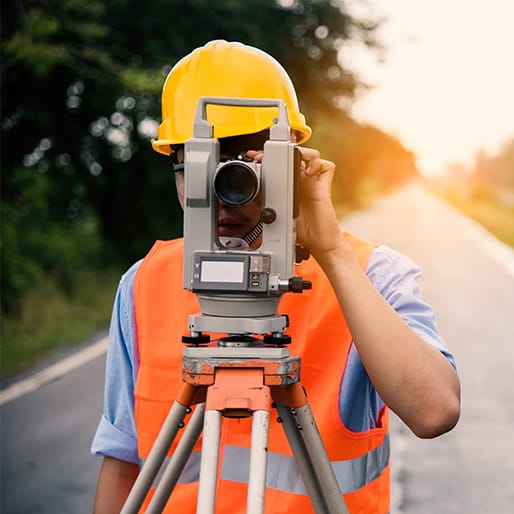
In the ever-evolving field of civil engineering, remote sensing technologies have emerged as powerful tools for enhancing survey accuracy and efficiency. At Afcones Infratech Pvt. Ltd, we harness these innovations to support infrastructure development and environmental assessments. This blog explores the diverse applications of remote sensing in civil surveys, highlighting its benefits and real-world examples.
What is Remote Sensing?
Remote sensing involves collecting information about an object or area from a distance, typically using satellite or aerial imagery. This technology allows us to gather data without direct contact, making it invaluable for large-scale surveys.
Advantages of Remote Sensing in Civil Surveys
- Increased Efficiency: Remote sensing can cover vast areas quickly, reducing the time needed for traditional surveys.
- Cost-Effectiveness: While the initial investment in technology may be high, the long-term savings from reduced labor and time make it cost-effective.
- Enhanced Accuracy: High-resolution imagery and advanced data processing techniques provide precise measurements.
- Accessibility: Remote sensing allows us to survey difficult-to-reach or hazardous areas safely.
- Real-Time Data: Many remote sensing systems offer near real-time data collection, enabling timely decision-making.
Key Applications in Civil Surveys
1. Land Use and Land Cover Mapping
Remote sensing helps in analyzing land use changes over time. By comparing historical and current imagery, we can assess urban sprawl, agricultural development, and environmental degradation.
2. Infrastructure Monitoring
Civil engineers use remote sensing to monitor the condition of infrastructure such as roads, bridges, and buildings. Techniques like synthetic aperture radar (SAR) allow for the detection of structural deformations and subsidence.
3. Environmental Impact Assessments
Before initiating projects, we conduct environmental impact assessments using remote sensing data. This information helps identify potential ecological impacts, allowing us to mitigate risks effectively.
4. Disaster Management
In disaster-prone areas, remote sensing plays a critical role in assessing damage after events like floods, earthquakes, and landslides. By analyzing imagery, we can identify affected regions and plan for recovery.
5. Urban Planning
Urban planners utilize remote sensing to design efficient cities. By analyzing population density, traffic patterns, and green spaces, we can create sustainable urban environments.
6. Geospatial Analysis
Remote sensing contributes to advanced geospatial analyses, enabling engineers to integrate multiple data layers for comprehensive assessments. This capability supports informed decision-making throughout the project lifecycle.
Technologies Driving Remote Sensing
- Satellite Imagery: Satellites provide high-resolution images that help in various applications, from monitoring land use to tracking climate change.
- LiDAR (Light Detection and Ranging): LiDAR technology uses laser pulses to measure distances, creating detailed 3D models of terrain and structures.
- Drones: Unmanned aerial vehicles (UAVs) equipped with cameras and sensors allow for detailed surveys of localized areas.
- Radar Systems: Synthetic aperture radar (SAR) provides valuable data in all weather conditions, making it suitable for continuous monitoring.
Case Studies
Case Study 1: Urban Expansion Analysis
In a recent project, we utilized satellite imagery to analyze urban expansion in a rapidly growing city. By comparing images from different years, we identified patterns of development and assessed their impact on local ecosystems.
Case Study 2: Bridge Monitoring
We deployed LiDAR technology to monitor the structural integrity of a critical bridge. By capturing detailed data over time, we detected slight deformations that informed maintenance schedules, ensuring safety.
Challenges and Considerations
While remote sensing offers numerous benefits, it also presents challenges. Data interpretation requires specialized skills, and the technology can be costly. Additionally, environmental factors like cloud cover can affect data quality. We prioritize training and investment in the latest technologies to overcome these hurdles.
Conclusion
At Afcones Infratech Pvt. Ltd, we recognize the transformative impact of remote sensing on civil surveys. By integrating these advanced technologies, we enhance our project outcomes and contribute to sustainable development. As we move forward, we remain committed to exploring innovative solutions that meet the evolving needs of the civil engineering industry.