Introduction: The Importance of Modern Surveying for Development
Modern Surveying for Development plays a crucial role in ensuring the efficiency and accuracy of construction and infrastructure projects. Incorporating modern surveying techniques helps developers, engineers, and architects gather precise data, enabling them to make informed decisions. Modern Surveying for Development is especially vital in today’s rapidly evolving industry, where innovation and accuracy are essential for successful project completion. From large-scale commercial buildings to residential developments, effective surveying techniques form the backbone of every infrastructure project.
What is Surveying and How Does it Relate to Infrastructure Development?
Surveying involves measuring and mapping land, structures, and other physical features. In the context of infrastructure development, surveying is the process of gathering critical data to inform the design and construction phases. For instance, topographic surveys help determine land elevation, slopes, and natural features, ensuring that construction aligns with the environment. This, in turn, ensures that the built infrastructure is both functional and sustainable.
- Land and boundary mapping: Defines property limits and construction zones
- Site preparation and planning: Helps engineers and architects design practical layouts
- Determining building elevations and slopes: Ensures structures are stable and safe
The Key Benefits of Surveying in Infrastructure Development
Surveying offers several important benefits that contribute to the overall success of infrastructure projects. Primarily, it ensures that construction activities are based on accurate data, reducing errors and delays. Moreover, it helps identify potential challenges early on, allowing for timely interventions. In addition, precise surveys reduce the risk of unanticipated issues that could arise during construction, ultimately saving time and money.
1. Accurate Planning and Design
Surveying provides engineers and architects with precise measurements that form the basis for detailed designs. Without this data, designs may not account for real-world conditions, resulting in structural inefficiencies or safety concerns. Thus, surveying ensures that the planning process is grounded in reality.
2. Cost Savings and Budget Control
By accurately defining the scope of work, surveying helps allocate resources efficiently. Therefore, construction teams can avoid unplanned costs caused by errors or changes in scope during the building process. As a result, projects are completed within the planned budget, and resources are maximized.
3. Risk Mitigation
Surveying helps identify potential hazards such as unstable ground or flooding risks. As a result, project teams can take proactive measures to address these challenges, ensuring that the infrastructure remains safe and secure. Additionally, this early identification of risks allows for the implementation of risk management strategies, preventing future complications.
How Surveying Ensures Safety and Regulatory Compliance
Safety and compliance with regulations are top priorities in infrastructure development. Through precise measurements, surveying ensures that construction projects adhere to local zoning laws and building codes. Moreover, survey data helps mitigate safety risks during construction. For instance, ensuring that buildings and roads are designed to avoid flood-prone areas reduces the potential for damage.
- Ensuring compliance with zoning laws: Helps avoid legal disputes and fines
- Preventing structural failures: Accurate measurements reduce the risk of faulty designs
- Maintaining public safety: Data supports the installation of infrastructure that won’t pose hazards to the community
chttp://Advancing Resilient and Sustainable Infrastructure
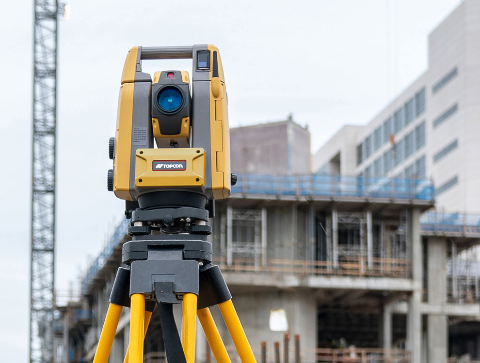
With the advent of technology, surveying methods have become more accurate, efficient, and versatile. For example, tools like GPS, drones, LiDAR, and total stations have revolutionized how surveyors capture data, especially for large-scale or complex projects. In addition, these technologies allow for real-time monitoring, improving decision-making during construction. This leads to quicker adjustments and more informed decisions.
1. GPS and GNSS Surveying
Global Positioning System (GPS) and Global Navigation Satellite Systems (GNSS) are used to capture accurate location data over large distances. This technology is essential for projects that span vast areas, such as highways or large commercial developments. Consequently, it enables surveyors to pinpoint exact locations quickly and precisely.
2. Drones for Aerial Surveying
Drones provide high-resolution aerial imagery, which is ideal for monitoring construction progress and analyzing site conditions from various perspectives. Therefore, they are especially useful for remote or hard-to-reach areas. Furthermore, drones reduce the need for manual labor, making the surveying process safer and more efficient.
3. LiDAR Technology
LiDAR (Light Detection and Ranging) uses laser beams to generate precise 3D models of landscapes. As a result, it’s incredibly effective for surveying challenging terrains like forests, mountains, and urban environments. Moreover, the data gathered through LiDAR allows for detailed modeling, which is essential for complex infrastructure projects.
How Surveying Contributes to Sustainable Infrastructure Development
Surveying not only ensures the functionality and safety of infrastructure but also supports sustainability. By integrating environmental assessments into the surveying process, planners can minimize the impact of construction on surrounding ecosystems. Moreover, accurate surveys help identify the most environmentally friendly methods of construction. Thus, infrastructure can be developed while preserving natural resources.
- Identifying sustainable locations for projects: Reduces the ecological footprint
- Minimizing environmental disruption: Ensures that construction has minimal impact on local wildlife and habitats
- Monitoring ecosystem health: Tracks changes in the environment during and after construction
Emerging Trends in Surveying for Infrastructure Developmenthttp://The Impact of Emerging Technologies on the Surveying …
As technology advances, so does the field of surveying. With the integration of AI, machine learning, and automation, the future of surveying holds great promise. These innovations will allow for faster, more accurate, and cost-effective surveying processes. In particular, AI-driven algorithms are expected to revolutionize the way data is analyzed and interpreted.
- AI-driven data analysis: Speeds up decision-making and reduces human error
- Autonomous vehicles and drones: Make surveying safer and more efficient
- Real-time data processing: Allows for faster adjustments during construction
Conclusion: The Unmatched Value of Surveying in Infrastructure Projects
Surveying is an integral component of infrastructure development. Without accurate surveying, construction projects would face unnecessary risks, delays, and costs. In conclusion, proper surveying ensures that infrastructure is built safely, efficiently, and sustainably. Therefore, it’s clear that surveying is indispensable to creating the foundations of modern society