
The Evolution of Drone Surveys in Infrastructure Projects
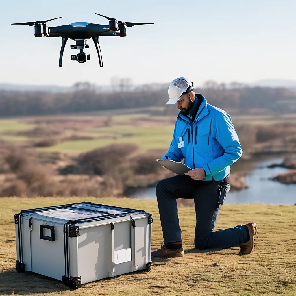
Drone surveys, utilizing UAVs, have revolutionized the way we capture high-resolution aerial imagery and gather critical data for infrastructure projects. This technology has become essential in modern surveying due to its numerous advantages:
High-Resolution Imaging: Drones equipped with high-resolution cameras capture detailed images of large areas, offering precise data for mapping and analysis.
Real-Time Data Collection: UAVs deliver real-time data, allowing for immediate analysis and decision-making during various project phases.
Cost and Time Efficiency: Automating data collection with drones significantly reduces the time and labor required for traditional survey methods, leading to substantial cost savings.
Key Benefits of Drone Surveys in Infrastructure Projects
Enhanced Accuracy and Precision
Traditional surveying methods, which often rely on manual measurements and ground-based observations, can lead to errors and inaccuracies. In contrast, drones provide detailed aerial views and data, enabling more precise measurements. They can create accurate topographic maps and 3D models, which are crucial for effective planning and execution of infrastructure projects.
Improved Project Efficiency
Drones excel in surveying large areas quickly. While traditional methods might take weeks or even months, drones can complete the same tasks in a fraction of the time. This speed is especially valuable in large-scale projects with tight deadlines, allowing for faster project turnaround and reduced delays.
Cost-Effectiveness
Although the initial investment in drone technology can be significant, the long-term savings are considerable. Drones reduce the need for extensive ground crews and expensive surveying equipment. By cutting labor costs and minimizing equipment expenditures, drones offer a cost-effective solution for infrastructure projects.
Enhanced Safety
Traditional surveying often requires personnel to work in hazardous environments, such as high elevations or unstable terrains. Drones eliminate the need for workers to be in these risky situations, enhancing safety on site. UAVs can access difficult-to-reach areas without endangering human lives.
Case Studies from India
Delhi-Mumbai Industrial Corridor (DMIC)
The Delhi-Mumbai Industrial Corridor stands as one of India’s most ambitious infrastructure projects, stretching over 1,500 kilometers and involving multiple states. The project aims to develop industrial zones, logistics hubs, and smart cities along the corridor. Given the scale and complexity, drone surveys have been instrumental in its development.
Applications of Drone Surveys:
- Site Mapping and Planning: Drones have extensively mapped the vast stretches of land along the corridor. The high-resolution aerial images and 3D models created have facilitated detailed site planning and obstacle identification.
- Progress Monitoring: Regular drone surveys enable project managers to monitor construction progress in real-time. This capability ensures the project adheres to its timeline and budget.
- Environmental Impact Assessment: Drones have assessed the environmental impact of the corridor development. They have provided valuable data on land use, vegetation, and potential issues, aiding in more informed decision-making.
Key Impact:
The use of drone surveys in the DMIC project has improved project oversight, enhanced planning accuracy, and enabled timely issue identification. The efficiency gained through drone technology has contributed to better resource management and adherence to project timelines.
The Bangalore Metro Rail Project, also known as Namma Metro, aims to expand the city’s urban transit network, alleviating traffic congestion and providing a reliable transportation mode. Given the urban environment and the complexity of integrating new infrastructure with existing systems, drone surveys have proven invaluable.
Applications of Drone Surveys:
- Construction Site Surveying: Drones have conducted detailed surveys of construction sites, providing high-resolution images and 3D models. This data is crucial for planning construction phases and assessing impacts on existing infrastructure.
- Urban Planning and Integration: Aerial views from drones have aided in understanding the city layout and integrating new metro lines with existing roadways and buildings. This integration is vital for minimizing disruptions and ensuring smooth operations.
- Public Safety and Communication: Drones have monitored public safety during construction and communicated progress to the public. Real-time data from drones allows for timely updates and improved transparency.
Key Impact:
Drone surveys have enhanced the accuracy of urban planning and construction management for the Bangalore Metro project. The technology has facilitated better integration with existing infrastructure and improved safety measures during construction.
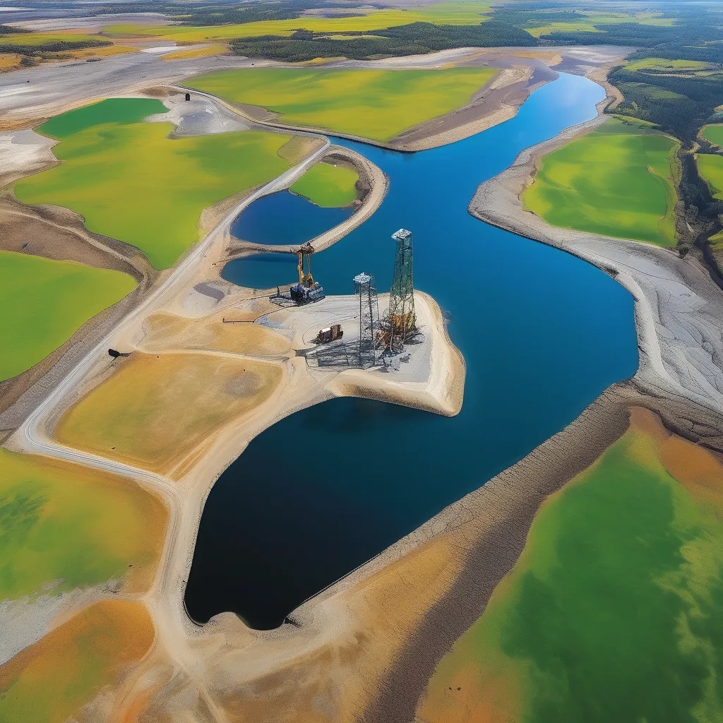
Ganga River Rejuvenation Project
The Ganga River Rejuvenation Project aims to clean and restore the Ganga River, which is crucial for the environmental and public health of the region. The project involves extensive work along the riverbanks and tributaries, making drone surveys a valuable tool.
Applications of Drone Surveys:
- Monitoring River Condition: Drones monitor the river’s condition, including sediment deposits, pollution levels, and changes in riverbanks. Continuous monitoring is essential for tracking the effectiveness of pollution control measures.
- Assessing Restoration Efforts: Aerial surveys provide data on the progress of riverbank restoration and the impact of various interventions. This information helps adjust strategies and ensure the success of restoration efforts.
- Emergency Response: Drones also play a role in emergency response situations, such as floods or pollution spills, by providing real-time data and enabling quick assessments of affected areas.
Key Impact:
The use of drone surveys in the Ganga River Rejuvenation Project has enhanced environmental monitoring and facilitated more effective restoration efforts. The technology has enabled better management of river health and a more responsive approach to environmental challenges.
The Future of Drone Surveys in Infrastructure Projects
As drone technology continues to advance, its applications in infrastructure projects are likely to expand further. Future developments may include:
- Enhanced Sensor Technology: Advances in sensor technology will provide even more detailed and accurate data, improving the quality of surveys and analyses.
- Integration with AI and Machine Learning: Combining drone data with artificial intelligence and machine learning algorithms will enable more sophisticated analysis and predictive modeling, leading to better project planning and management.
- Wider Adoption in Various Sectors: As the benefits of drone surveys become more widely recognized, their use is expected to increase across different infrastructure development sectors, including transportation, utilities, and urban planning.
Conclusion
Drone surveys are transforming the planning, execution, and monitoring of infrastructure projects. In India, the adoption of drone technology has led to significant improvements in accuracy, efficiency, and cost-effectiveness across various projects. Case studies from the Delhi-Mumbai Industrial Corridor, Bangalore Metro Rail, and Ganga River Rejuvenation Project demonstrate the profound impact of drone surveys on infrastructure development. As technology evolves, drones are poised to revolutionize infrastructure projects even further, promising greater advancements in the future.uture.