GIS Work Explained: Uses, Process, and Applications
Introduction to GIS Work
Geographic Information System (GIS) work plays a crucial role in today’s data-driven world. In today’s environment, organizations increasingly rely on GIS to understand spatial relationships, visualize complex information, and make informed decisions. As a result, industries such as urban planning, infrastructure development, environmental monitoring, and disaster management depend heavily on GIS technology.
In simple terms, GIS work combines geography, data analysis, and modern technology. Instead of using only raw tables or static reports, professionals apply GIS tools to convert data into maps, layers, and interactive visualizations. Because of this, decision-makers can understand information faster and act more confidently.
In this article, we explain what GIS work involves, discuss its components, review applications, and examine future opportunities.
What Is GIS Work?
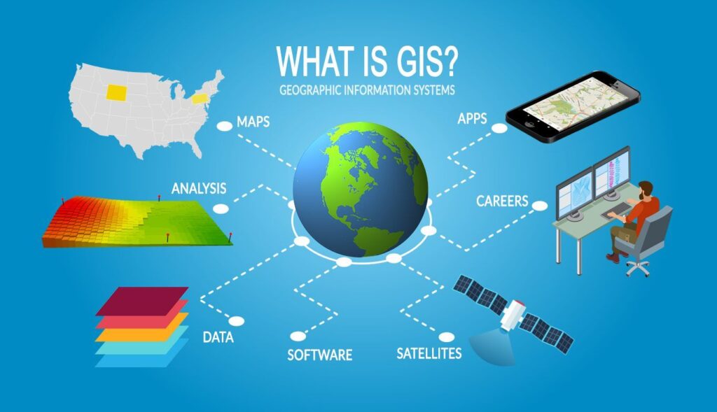
GIS work refers to the collection, management, analysis, and presentation of geographic data using GIS software. In practice, it focuses on questions related to location, patterns, trends, and spatial relationships on the Earth’s surface.
For example, GIS professionals work with maps, satellite imagery, survey data, GPS information, and spatial databases. By combining these datasets, GIS helps users analyze real-world problems and develop reliable solutions.
Key Components of GIS
Spatial Data
Spatial data represents the geographic location of features such as roads, rivers, buildings, land parcels, and utilities. Generally, GIS uses two main spatial data formats.
First, vector data includes points, lines, and polygons used for mapping features like roads and boundaries. Second, raster data includes satellite images, aerial photographs, and digital elevation models. Together, these data types support accurate spatial analysis.
Attribute Data
Attribute data describes the characteristics of spatial features. For instance, a road layer may include the road name, width, surface type, and condition. When this information is linked with spatial data, users can query and analyze features efficiently.
GIS Software
GIS software enables users to analyze and visualize geographic data. Commonly used tools include ArcGIS, QGIS, Global Mapper, AutoCAD Map, and Google Earth Pro.
Although each tool differs slightly, all of them support mapping, spatial analysis, and database management.
Hardware and Infrastructure
GIS work also depends on suitable hardware and infrastructure. Typically, professionals use high-performance computers, GPS devices, drones, servers, and cloud platforms. With these tools, teams can process large datasets accurately and quickly.
Skilled Professionals
Skilled professionals play a vital role in GIS projects. In most cases, GIS analysts, surveyors, planners, and engineers apply technical knowledge to convert raw data into meaningful outputs. Because of their expertise, GIS results remain reliable.
Types of GIS Work
Data Collection and Creation
Most GIS projects begin with data collection. At this stage, professionals gather data from GPS surveys, RTK systems, drone mapping, satellite imagery, and government sources.
After collection, they digitize maps, create layers, and assign attributes. As a result, the dataset becomes ready for analysis.
Spatial Data Analysis
Spatial analysis forms the core of GIS work. Using GIS tools, professionals identify patterns and relationships in geographic data.
Common techniques include buffer analysis, overlay analysis, network analysis, terrain analysis, and hydrological modeling. Through these methods, GIS reveals insights that traditional data cannot show.
Mapping and Visualization
GIS converts complex data into understandable maps. For example, professionals create land use maps, infrastructure maps, flood maps, and transportation maps.
As a resulhttps://x.com/homet, visualization improves communication and decision-making among stakeholders.
Database Management
In addition to mapping, GIS work includes database management. This process involves data validation, regular updates, and integration from multiple sources. When databases are maintained properly, GIS systems remain effective over time.
Applications of GIS Work Across Industries
GIS in Urban Planning and Smart Cities
Urban planners use GIS to analyze population growth, land use patterns, traffic flow, and utilities. With GIS support, planners develop master plans, zoning strategies, and smart city solutions.
GIS in Infrastructure and Construction
GIS work supports infrastructure projects such as roads, railways, bridges, pipelines, and irrigation systems. During planning, engineers use GIS to select alignments and analyze terrain. During execution, teams monitor progress and manage assets efficiently.
GIS in Environmental Management
Environmental experts rely on GIS to monitor ecosystems. For instance, GIS supports forest analysis, water management, environmental impact assessments, and climate studies. Over time, this helps track environmental changes.
GIS in Disaster Management
GIS plays a key role in disaster preparedness and response. Before disasters, authorities prepare hazard maps. During emergencies, GIS supports response planning and damage assessment.
GIS in Utilities and Asset Management
Utility companies use GIS to manage water, sewerage, power, and telecom networks. By using GIS, organizations improve maintenance planning and reduce service disruptions.
GIS Work Process and Workflow
Problem Definition
Every GIS project starts with a clear objective. At the beginning, teams define the problem and expected outputs.
Data Collection
Next, GIS professionals collect accurate spatial and attribute data. If this step is done correctly, later analysis becomes reliable.
Data Processing
Afterward, teams clean, georeference, and organize the data into layers. This preparation supports smooth analysis.
Spatial Analysis
Then, analysts apply GIS models and tools to extract insights. As a result, raw data becomes useful information.
Map Creation and Reporting
Finally, professionals present outputs through maps, dashboards, and reports. Because of clear visualization, stakeholders can easily understand results.
Skills Required for GIS Work
To succeed in GIS work, professionals need technical and analytical skills. These include knowledge of cartography, GIS software proficiency, surveying skills, and basic programming.
In addition, communication skills help explain results to non-technical users.
Advantages of GIS Work
GIS offers several benefits. For example, it improves decision-making accuracy, saves time and cost, enhances visualization, and supports planning. Because GIS integrates multiple datasets, organizations gain better control over information.
Challenges in GIS Work
Despite its advantages, GIS work faces challenges such as data quality issues, high initial costs, and skill shortages. However, proper training and planning can reduce these problems.
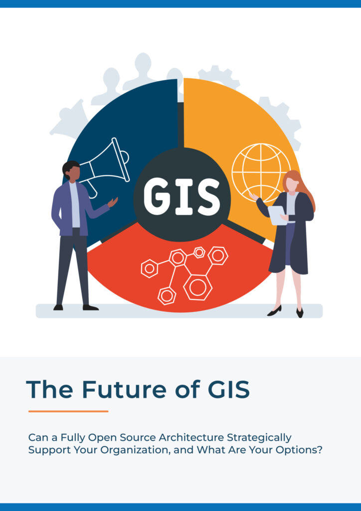
Future Scope of GIS Work
The future of GIS work is promising. With advancements in technology, artificial intelligence, machine learning, cloud GIS, drone mapping, and real-time data integration continue to expand GIS capabilities.
As industries adopt digital solutions, demand for GIS professionals will continue to grow.
Conclusion
GIS work has transformed how organizations analyze spatial data. By linking location with information, GIS supports smarter planning and efficient management.
Therefore, as technology evolves, GIS will remain a critical tool for solving real-world problems.